Sahaara: An app to stay connected during emergencies
India has seen devastating natural calamities rattle the daily lives of the common man. Floods, earthquakes, cyclones and landslides are just few of the many adversities we have faced. While the National Disaster Management Authority (NDMA) has policies (2009) and plans in place, it is usually the common man who come out to help each other.
Communities usually rely on existing media such as phone calls and apps such as Whatsapp, Facebook, Instagram etc. and do not have a platform that addresses multiple problems that specifically arises during natural disasters.
Client
Design Task (Self)
Duration
07 Days
Role
UX Designer
Tools
Figma
Timeline
Day 1
Day 2
Day 3
Day 4
Day 5
Day 6
Day 7
Research
Ideation
Wireframing
Finale screens & prototype
Process
Assess
Understand
Ideate
Deliver
Test
Team
Since this brief was worked on as part of a design task, it was a self lead project.

The ask
Device a platform for local communities to stay connected in situations of emergencies incorporating features that solve for relevant pain points that arise from user research.
Assess
Peers and the problem
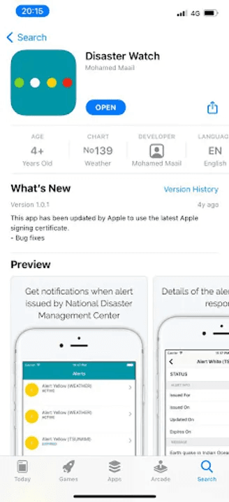
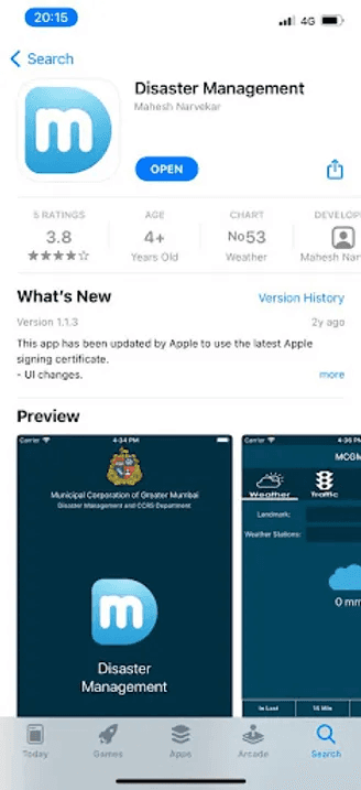
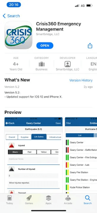
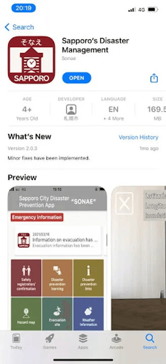
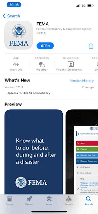
I started off by understanding other solutions currently available. The few solutions I found did not fall under the niche I was solving for. While some of them catered to specific geographic locations, some of them were only sharing warnings and static information, that too of certain types of predictable calamities.
Domestic apps
Cater to only specific locations
Only provide information regarding natural disasters, not for communication
Other apps
Specific to certain countries
Have more features
Is more accommodating
Understand
Values to reflect in the solution
Moving forward, it was necessary to consider 3 main aspects to resolve this problem:
Affordability
The solution must be accessible and affordable to as many people, from any location via most devices. This should also translate across network connectivity if possible.
Reliability
The response or resources received must be useful, immediate and reliable. Users must trust the platform enough to approach it first and seek the best solution available
Ease of Use
The platform must be simple and all information must be prioritized and be accessed easily. There shouldn’t be any room for confusion while using the service.
Key research areas
It was necessary to understand 3 key areas before solving the problem:
Context
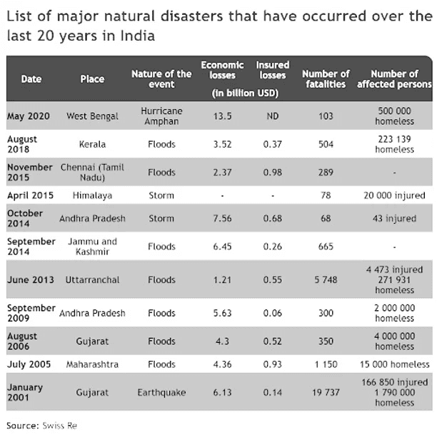
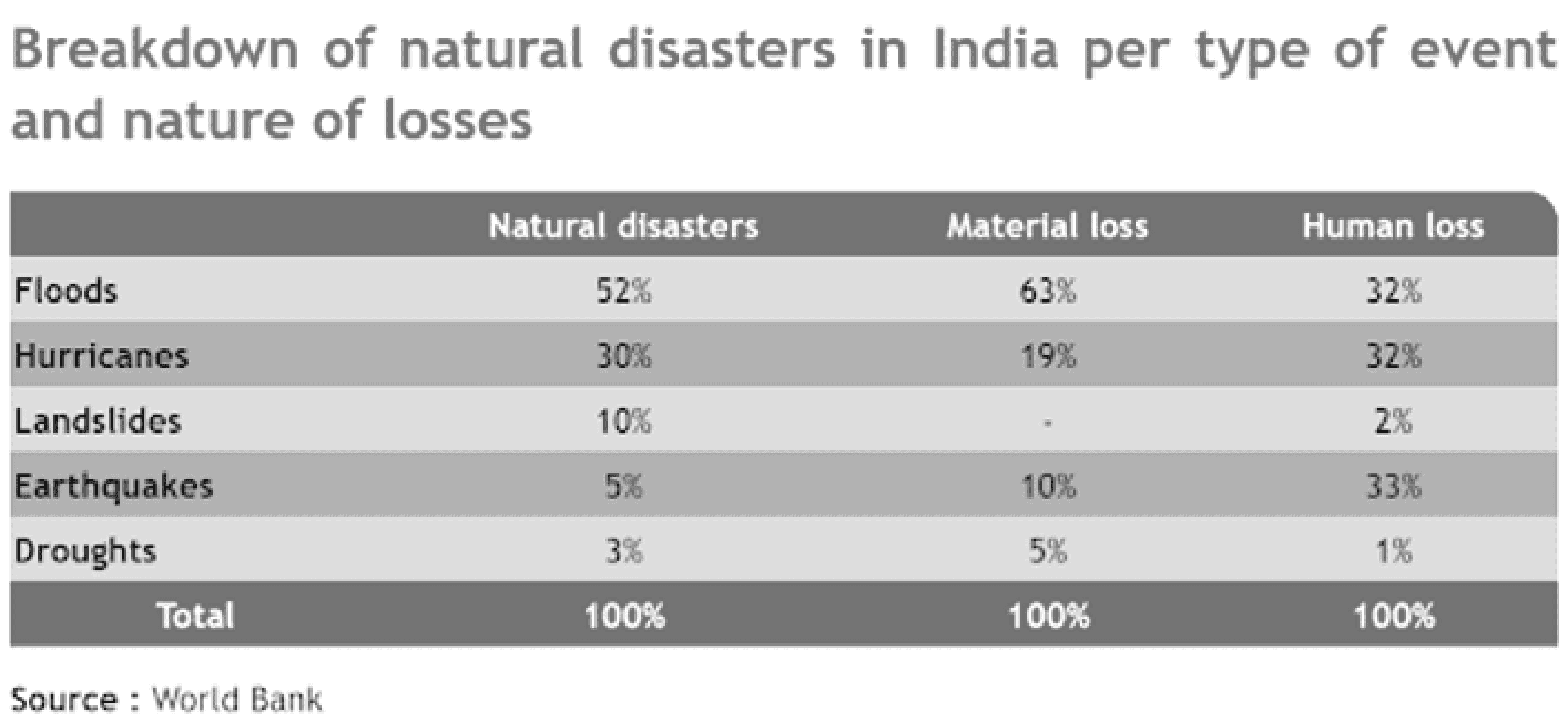
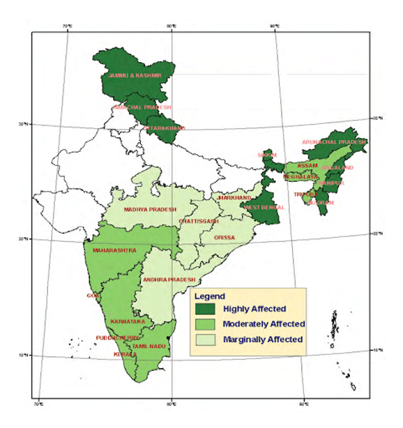
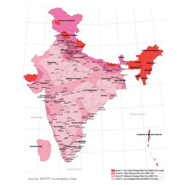
Natural disasters in India
What are the different calamities that occur in India?
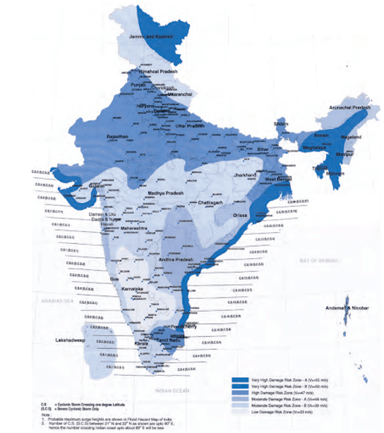
Which regions in India are prone to what kind of natural disasters?
When do they occur?
How frequently do they occur?
User research
Awareness
What do they know about natural disasters?
How prepared are they?
Do they know basic first aid/CPR?
Skills
Are they well versed to face adversities?
What all skills do they have?
What all skills can be put to use in an adverse situation?
Are they encouraging community skill development?
Experiences
Have they faced natural calamities before?
How did they handle past experiences?
Feelings
How would they react in emergencies?
Are they mentally strong?
Do they have past trauma?
Available technology
Local & affordable
Mobile networks, Satellite phones, HAM radio services, Radio services, GPS, Bluetooth powered mesh networks
Context
Natural disasters in India
Earthquake Prone Zones
Landslide Prone Zones
Flood Prone Zones
Wind & Cyclone Prone Zones
User research
Interviews were conducted via phone calls and insights were drawn from 5 people who had experienced a natural disaster in the past and/or volunteered to provide services and/or donated resources. The purpose was to map out the methods they took, effectiveness of completing a task and ease of achieving goals they wished to.
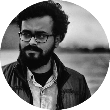
Sumit, 28
Assam
"Even though we anticipate these every year, it is still taxing on our mental health. We are constantly living in fear that is not a good feeling."

Vinu, 40
Thiruvalla
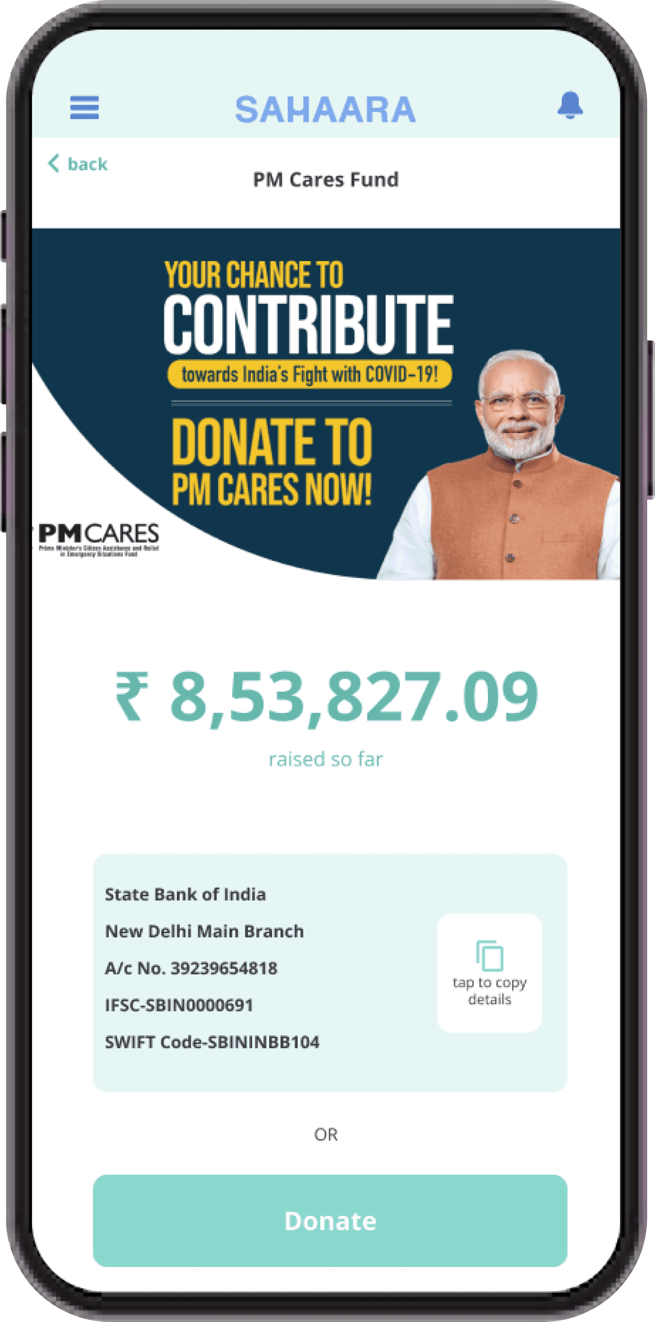
"A lot of people come forth to help but collecting funds is a problem. Most people are skeptical to donate or simply can’t afford to."
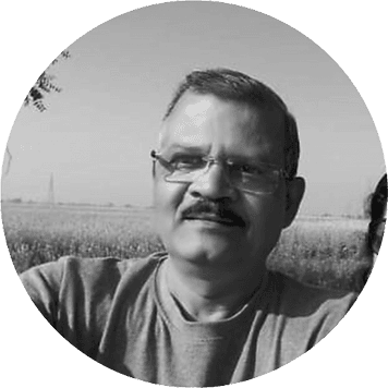
Bindu, 45
Thiruvalla
"The problems don’t persist for more than 2 or 3 days. Property damage and insurance claims are a pain though!"

Prakash, 64
Mumbai
"We are used to the rains and floods. Only very rarely does it get bad. Relief camps are set up and emergency kits are distributed only in rural areas where people need it more."

Arya, 24
Kochi
"Experiencing floods while being away from family would have been an emotionally draining experience if it weren’t for my kind neighbors."
Available technology
GPS
It is a satellite-based navigation system that enables users to determine their precise location on Earth by receiving signals from a network of orbiting satellites, providing accurate positioning information for various applications. It doesn't require mobile network.
Radio services
Radio services involve the transmission of data through electromagnetic waves, allowing for widespread communication via devices such as radios, broadcasting stations, and digital platforms. It enables one-way communication without requiring network connectivity.
HAM radio services
HAM radio, or amateur radio allows licensed individuals to communicate globally using designated radio frequencies for non-commercial purposes, fostering technical skills and emergency communication capabilities. But the number of ham radio operators are limited due to licensing requirements.
Mesh networks
It is possible to use bluetooth technology and a peer-to-peer network to create what's called a "mesh network." Users can create local networks within a 200-foot range, and this network can (theoretically) grow depending on how many users are within range.
Satellite phones
Satellite phones use satellites orbiting the Earth to facilitate voice and data communication in areas with limited or no traditional cellular network coverage. It can be used only with specific permission/ NOC from the GOI which restricts the popularity of satellite phones.
Mobile networks
Mobile networks enable communication between mobile devices, using radio signals to connect to cellular towers. Currently, 34% of India’s population uses mobile phone internet. Two in every three users are expected to have a mobile phone by 2023, while one in two users will have a smartphone.
Insights
Corruption and misuse of resources are rampant but these don’t affect volunteers and donors
Local groups have databases of reliable resources and contacts who can lend situation specific help
People come together despite all odds to volunteer and help others but collecting funds for various activities are a major challenge
Slacking on the part of government and local concerned authorities affects the rightful allocation of disaster management funds
People in frequently affected areas are always prepared for adversities. It is the surprise element that causes more shock and damage.
Resources are aplenty; redistribution is managed efficiently by local communities and volunteer groups
Floods, cyclones and earthquakes that occur annually affect small regions only for a period of 2-3 days on an average. Major disasters are still rare in India.
Network connectivity and power outages haven't been a major problem as anticipated
Stakeholders
PRIMARILY IMPACTED
Those who bear the brunt of the disaster and are immediately affected
Survivors
FIRST RESPONDERS
Those who witness and come forth to assess the scenario and help save lives
locals, volunteers, fire fighters, policemen, nurses, doctors
FRIENDS & FAMILY
Those afar, worried and concerned about the safety of their loved ones
family, friends, relatives
OTHER STAKEHOLDERS
Those who assess the situation with gathered data and manage the resources
Government, district collector, ward member, NGOs
User archetype
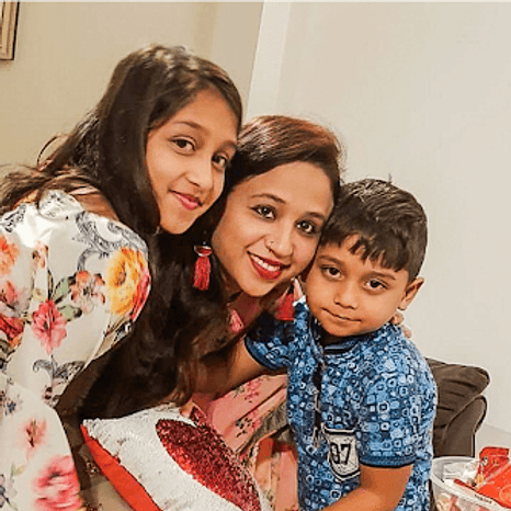
Geeta, 38
Homemaker, Pune
Goal:
Easy access to help without much complications or many steps
Motivation
Dependancy
Convenience
Urgency
“I am a homemaker and head of family and I want a platform to seek assistance with relocation during floods that occur annually in my area.”
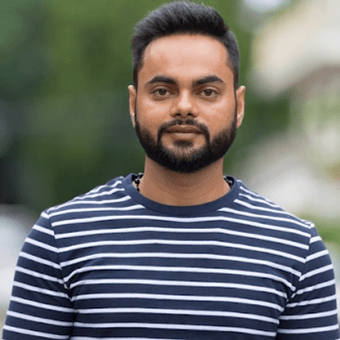
Kunal, 26
Local business owner, Guwahati
Goal:
Better planning for quick resolution of problems and proper utilisation of resources
Motivation
Dependancy
Convenience
Urgency
“I am a regular volunteer and I want a platform that will help me find those who need my assistance and also help me donate to those who need it the most.”
How Might We
Based on the research, few How Might We questions were framed to understand which pain point to solve for,
How Might We
enable communication
for home makers
to seek basic home supplies
How Might We
draw shelter camp information
for volunteers
to provide service as needed
How Might We
solve for connectivity
for stranded victims
in order to send SoS messages?
How Might We
provide relief
for worried kin
to connect with stranded friends and family?
How Might We
bridge the gap and eliminate miscommunication
for organisations
to seek donations?
Understand
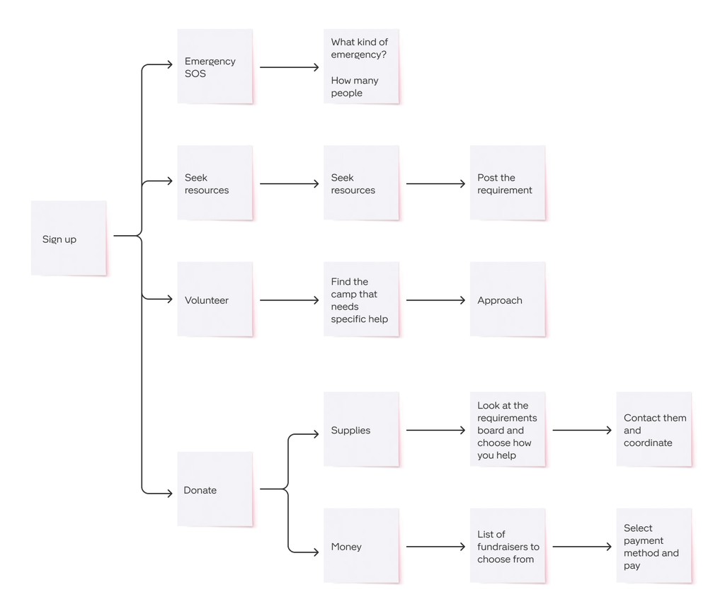
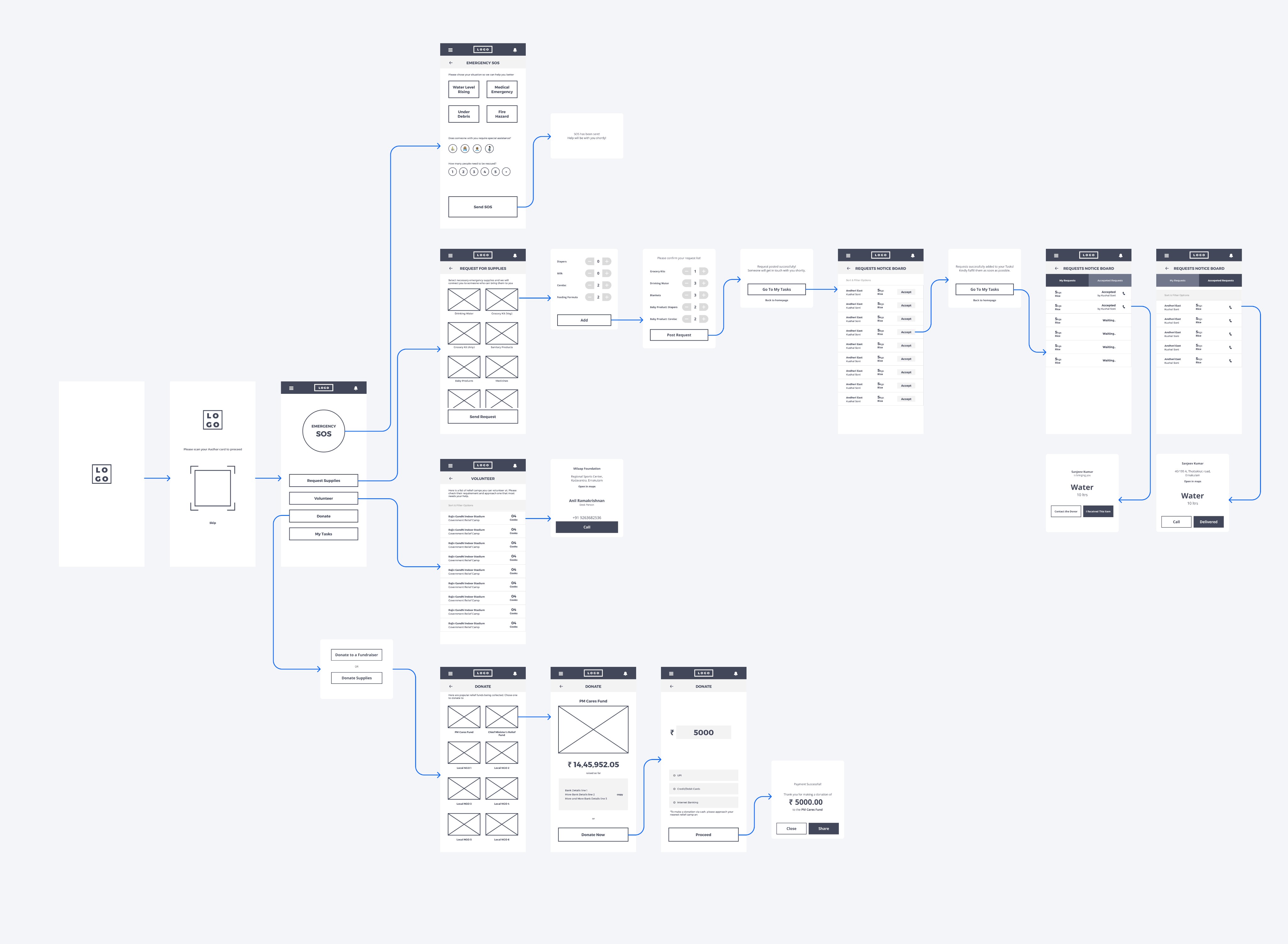
How does one seek help? How does one volunteer? How do they donate?
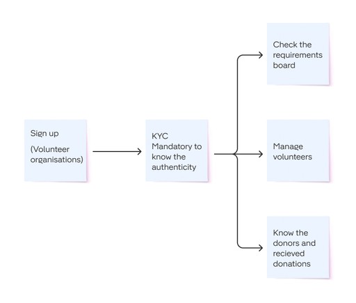
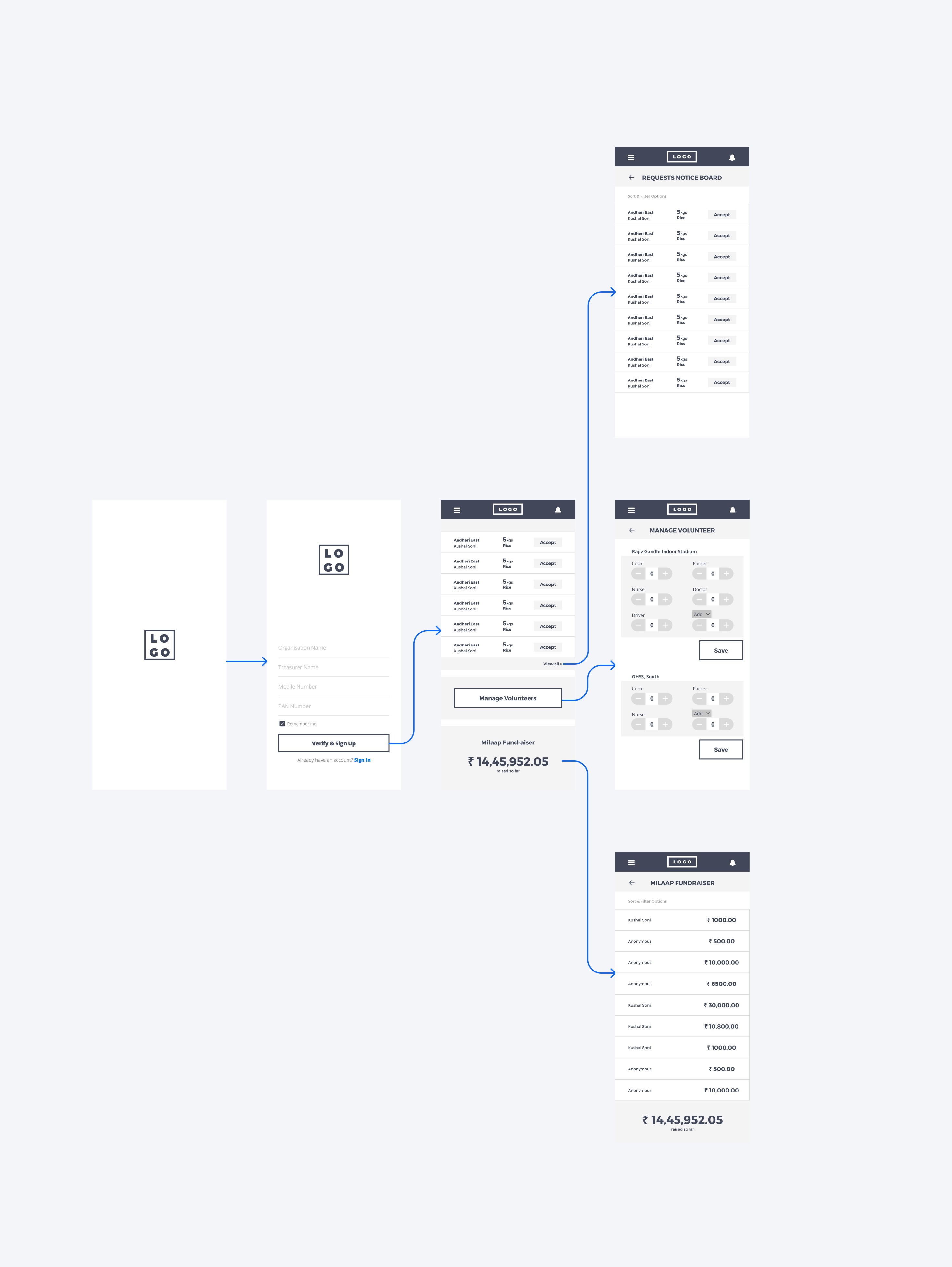
From the data that stems from the research, it was understood that there needs to be two different channels; one for individuals and one for volunteer organizations.
Individuals must have the option to seek help, donate and/or volunteer.
Organizations needs the additional option to seek donations and volunteers.
A GPS aided channel incase of network outages.
User flow for individual users
User flow for volunteer organisations
User flow in emergencies
Wireframes
Deliver
View resume
What would I do different?
Features
Add a space to search for missing people
Get much advanced weather alerts, well in advance and very specific to geography
Preparedness coaching and kit preparation tips
Inclusivity
Multilingual interface catering to the diversity of India
Voice input and other methods for accessibility
Scalability & Responsiveness
Give the platform a web based interface as well for better accessibility
Can this be integrated into smartwatches or cheaper wearable devices using the existing technology?
Back to top
